The Canary Islands, situated off the northwest coast of Africa, offer some of the most diverse and spectacular hiking trails in Europe. With seven main islands to choose from – Tenerife, Gran Canaria, La Palma, El Hierro, La Gomera, Fuerteventura, and Lanzarote – deciding which island is best for hiking depends on the type of landscape and experience you’re looking for.
Tenerife
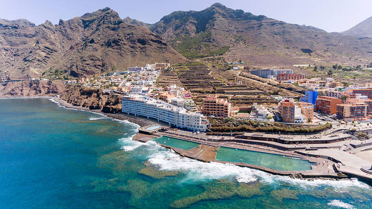
Tenerife, the largest of the Canary Islands, boasts incredible geographical diversity perfect for hiking. Dramatic volcanic landscapes, lush forests, historic towns, and sandy beaches can all be explored on foot.
Masca Gorge Descent
This epic 5-6 hour coastal hike descends 800m down a steep, narrow gorge passing remote mountain hamlets before emerging at the sleepy village of Masca. From there, boat transport returns hikers to Los Gigantes resort. The descent route’s stone steps, shear drops, and uneven terrain place this trail at expert difficulty.
Anaga Cloud Forest
In Tenerife’s remote northeast pocket lies the peaceful Anaga Mountains whose laurel forests and farmed valleys feel worlds away from the resorts. Hikers of most abilities can explore this protected biosphere along gentle forest tracks and steeper routes to charming hamlets like Chamorga with ocean vistas.
CHINYERO VOLCANO – TENERIFE
This short 2-hour hike near Santiago del Teide ascends to the Chinyero volcanic cone’s summit at just over 1300m elevation. The well-defined path and slopes make it an easier volcanic landscape hike with superb views over to Mt Teide and the surrounding pine forest.
CALLEJÓN DE TENO AND BARACÁN SUMMIT – TENERIFE
Traversing Tenerife’s remote Teno Mountains on the northwestern coast, this strenuous 12km route navigates the rugged Callejón de Teno gorge to eventually reach the highest peak in western Tenerife – Baracán at 1,256m. Parts of the 6-hour trek require sure footing across steep terrain with rewarding ocean panoramas.
PUNTA DE HIDALGO – CHINAMADA – TENERIFE
This moderate half-day, 7km coastal hike near Anaga Rural Park travels from Punta de Hidalgo to Chínamada village. The trail meanders downhill through tranquil terraced farmlands dotted with traditional cottages. Dramatic ocean overlooks feature throughout.
Hiking Guide – Tenerife
For first-timer hikers, Teide National Park offers spectacular but straightforward day walks taking in bizarre lunar landscapes and sprawling views. There are also rewarding but more challenging ridges and summits for experienced hikers, like the iconic ridge to Mt Teide – Spain’s highest peak.
Outside the national park, highlights include the peaceful Anaga Rural Park in the northeast of Tenerife with coastal forests and small traditional villages connected by ancient mule tracks. The remote Teno Rural Park in the northwest also holds tucked-away hamlets, with barrancos (ravine routes) down to the ocean.
Trails – Tenerife
The end-to-end Coast-to-Coast Route is a classic multi-day Tenerife hike crossing the whole island from Playa Paraíso to Punta de Teno. The paths lead through the island’s incredible diversity of landscapes from beach to pine forest to desert to high mountain terrain.
For stunning coastal views, the hike from Los Gigantes to Santiago del Teide traverses breathtaking clifftops and Masca’s steep gorge to charming mountain hamlets. The route to the historic hamlet of Chirche also shouldn’t be missed.
Gran Canaria
Gran Canaria’s rugged circular central mountains, steep ravines, and remote peninsulas set an adventurous hiking tone. Most trails here offer steeper, more technical terrain – perfect for fit trekkers keen on epic viewpoints and varied volcanic landscapes away from the main tourist resorts.
LLANOS DE LA PEZ – PICO DE LAS NIEVES – GRAN CANARIA
This challenging 10-hour, 16km summit bid leaves from Llanos de la Pez on a winding path up Gran Canaria’s highest mountain – the 1949m Pico de Las Nieves. After steep sections negotiating pine forest and then exposed rock, triumphant hikers gain 360-degree island views and even sights of Tenerife.
ROQUE NUBLO – GRAN CANARIA
Few images embody Gran Canaria more than the towering 80m volcanic rock monolith of Roque Nublo. Located inside rural Tejeda, this iconic mountain hike takes around 3 hours to return along a well-defined path with some steep steps. The scenery and sheer rock spectacle throughout make it an unmissable area for hiking.
Hiking Guide – Gran Canaria
For hikers new to Gran Canaria, the central Cruz de Tejeda region is one of the island’s most beautiful spots with easier walks amongst pine trees and charming mountain villages with magnificent vistas.
More experienced hikers should consider summit attempts of Gran Canaria’s iconic peaks. Pozo de Las Nieves (1949m) offers challenging rock scrambles and views across much of the island. The demanding full-day hike of Roque de Los Muchachos (2423m) takes in forests, cliffs, and the island’s highest vantage point.
Trails – Gran Canaria
A favorite multi-day coastal trail is between the pretty towns of Agaete and Mogán passing through diverse landscapes like Tamadaba Forest, picturesque hamlets, banana plantations, and rugged ravines.
Inland, the remote central GC200 Circular Route travels deep into the heart of Gran Canaria through hollow gorges, rolling pastures with herds of sheep and goats, and typical mountain hamlets virtually untouched by mass tourism.
La Palma
Nicknamed “La Isla Bonita”, La Palma rightfully claims the title as the Canaries’ most beautiful island, especially where hiking is concerned. Unspoiled forests, volcanoes, and villages offer discovery around every corner without the distraction of mass tourism.
THE VOLCANO TRAIL – LA PALMA
This challenging 12km route traverses the outer slopes of San Antonio volcano over 7 hours through pine forests and up painfully steep inclines. Upon reaching the crater, hikers gain sublime views over nearby Fuencaliente town – known for its hot springs and vineyards.
ROQUE DE LOS MUCHACHOS TRAIL – LA PALMA
As La Palma’s highest peak, this mighty volcano can be summited from multiple directions. One of the most scenic trails leaves from Puntagorda town, taking 9 hours over 14km through fruit orchards and cloud forest before climbing over large boulders to the 2426m summit for island-wide views.
Hiking Guide – La Palma
First-timers should stay within the verdant Caldera de Taburiente National Park – an enormous erosional crater of lush forests and views over to El Hierro and La Gomera. Easier trails explore the forests along the crater base with glimpses of the dramatic inner walls. More challenging hiking trails switch back steeply up 1000m to viewpoints like Bejenado Peak.
More remote parts of La Palma open up endless options for multi-day coastal walks and trans-island traverses. The imposing northern cliffs and forests of Los Tilos deliver unbeatable wilderness hiking. The southern Volcano Route is another favorite – ascending the towering Roque de Los Muchachos volcano for views over the entire island.
Trails – La Palma
La Palma’s long-distance GR130 circles the entire island taking in forests, farmlands, hamlets, volcanoes, and the coastline. Highlights include the descent through the world’s largest erosion valley – Barranco de las Angustias – and views from the island’s apex at Roque de Los Muchachos.
For a remote multi-day coastal hike, the trail heads north from Fuencaliente town into the little-visited Volcanoes Nature Reserve. The route travels along high clifftops and black volcanic beaches in the south. Further on, the diverse northern landscapes feature banana plantations, pine forests, and pretty coastal hamlets abundant with flowers.
El Hierro
As the Canary’s westernmost island, El Hierro’s remote location and peaceful villages attract hikers seeking magnificent scenery without crowds. Mostly shorter coastal trails exist here, but the imposing central mountains deliver challenging ridge-line trails for hardy trekkers too.
LA LLANÍA – EL HIERRO
This advanced trail traverses the remote sheer cliffs of La Llanía on El Hierro’s western extent over 8km. Considered one of the Canaries’ most stunning hikes, the path remains narrow and dizzyingly exposed – demanding agility and a good head for heights. Cairns sometimes marks the route as it passes herb fields and nears the coast.
Island-Hopping Trails
While each island shines individually, the proximity of the Canaries allows fit hikers to link routes across islands. Trails like GR131 and various coastal paths trace joining sections across La Gomera, Tenerife, and El Hierro encouraging multi-day exploration.
Hiking Guide – El Hierro
For less experienced hikers, trails in the lush El Golfo valley are most accessible. The valley features ancient juniper trees, views of the iconic El Golfo rock slide, and pretty coastal tracks passing through banana groves. The trails to Guarazoca village and then on to Las Playas black sand beach also showcase El Hierro’s best landscapes in a straightforward day hike.
More advanced hiking extends into the remote northwest Malpaso region with ancient trails across rocky terrain and imposing cliffs. Or head south from the peaceful capital Valverde along mountain ridges to the central Guarazoca valley with some steep and exposed sections.
Trails – El Hierro
El Hierro’s long-distance trans-island hike – the GR131 – can be split over several days to cross through the island’s little-explored heart. Starting from the coast in the Valle del Golfo region, the trails pass through peaceful pine forests, remote hamlets, and eventually the dark volcanic ridge of Julan to finish at the remote west coast with huge sea cliffs.
For a coastal multi-day hike, head west from the capital Valverde to traverse the rugged northwestern peninsulas of Orchilla and Andén Verde finishing at the remote lighthouse overlooking the Atlantic Ocean. Expect steep hill climbs through ancient Canarian pine forest and onto the wind-battered headlands with views across to La Gomera island.
La Gomera
With its UNESCO-protected laurel forests and black sand beaches linked by steep ravines, tiny La Gomera makes up for its size with majestic scenery. Remote settlements here feel untouched by modern life, adding to the sense of adventure. The challenging terrain favors experienced trekkers.
LAGUNA GRANDE – ALTO DE GARAJONAY – LA GOMERA
A strenuous day hike within Garajonay National Park first climbs through ancient jungle-like forests along rocky paths before emerging at Laguna Grande – a serene mountain lake. Further steep switchbacks continue to the summit at 1487m on Alto de Garajonay – La Gomera’s highest point – for scenic views across the cloud forest.
Hiking Guide – La Gomera
The kinder northern slopes feature pine forest ridges and delightful coastal tracks like those to Playa Santiago. Heading inland from Vallehermoso, a web of historical cobblestone trails thread through peaceful hamlets and pastures to Roque Cano Peak with views over towering cliffs and neighboring islands.
The true hiking treasures lie in the remote inland Garajonay National Park – a UNESCO-protected laurel forest hosting plants and wildlife found nowhere else on Earth. Several trails of varying difficulty ascend through this misty temperate forest to the summit of Alto de Garajonay mountain.
The routes then continue down through ancient ravines, ridges, and valleys untouched for centuries on the way to charming southern towns like Agulo and Hermigua. Parts of these hikes require sure footing, moderate fitness, and possibly local guiding.
Trails – La Gomera
The most popular long-distance trail is the 11-day GR132 circumnavigation revealing the island’s every facet – from the cloud forest and ridges of Garajonay National Park to banana plantations, quiet hamlets, and breathtaking coastal vistas in the north and south.
The extremely remote Dry Stone Route to the far west heads from Valle Gran Rey over steep barrancos, high ridges, and along dangerous sea cliffs only navigable by the experienced and fit. At the trail’s end are mind-blowing views of the Unesco-protected Dry Stone Structures – ancient houses built ingeniously from volcanic rock on an area otherwise devoid of building materials.
Fuerteventura
With 150km of sandy beaches and volcanic landscapes, Fuerteventura showcases a unique island vibe amongst the Canaries. Hiking here focuses along scenic coastal tracks passing traditional whitewashed villages, migratory bird habitats, and on inland routes to barren volcanic craters.
Hiking Guide – Fuerteventura
The most popular trails allow easy walking for several hours along pristine beaches and small bays north of Corralejo. Routes also cut inland through protected dunes passing ancient majorero houses and desert plants to reach peaceful hidden coves.
Further south, hikers can discover picturesque villages via the smell of coastal paths near La Oliva and El Cotillo. Inland tracks also lead from charming Betancuria – the island’s old capital – past isolated mountain hamlets and to the volcanic Montaña Tindaya sacred site.
For more challenging but rewarding hikes, the trails west of Valle de Santa Inés offer panoramic views over to Lanzarote Island. Fit hikers can also follow scenic ridges inland to the volcanic craters of Los Helechos de Bco. de las Peñitas.
Trails – Fuerteventura
The diverse GR131 Circular Route allows hikers to experience the breadth of Fuerteventura’s landscapes from mountain to ocean over 6 days of hiking.
Starting in La Pared town, the trail heads into the protected Betancuria Rural Park through dry barrancos. Further along the windswept western coast, the route passes old lighthouses towards towering 500m sea cliffs – some of the highest in Europe.
The final leg heads south traversing desert plains and volcanic craters. Ancient cave settlements and panoramic views feature throughout the hike.
Lanzarote
As the easternmost Canary Island, Lanzarote’s volcanic origin and proximity to the African coast imbue its landscape with a desert island feel unique in the archipelago. Yet verdant vineyards, white-washed villages, and spectacular coastlines also abound.
Hiking Guide – Lanzarote
For straightforward day hikes, the areas around Timanfaya National Park, La Geria Wine Region, and El Golfo on the West Coast have beautiful trails suited to most fitness levels and families. Visitors can take in multicolored volcanic earth, green vineyards, and the shores of the Atlantic amongst these interesting landscapes.
More advanced hiking happens along the northern coast, especially on the remote Famara Massif peninsula. Trails to the Peñas del Chache lighthouse have challenging inclines but deliver breathtaking views over the rugged Famara cliffs to Isla Graciosa and beyond.
Trails – Lanzarote
The diverse GR131 Circular Hiking Trail reveals the best of Lanzarote over 7 days. The route takes in olive groves around Haría town, the lunar wilderness of Timanfaya National Park, golden beaches, and sleepy fishing villages like Arrieta, and finishes along the Famara Massif peninsula with towering sea cliffs.
For multi-day coastal walks, the hidden coves and beaches around the Parque Natural Los Ajaches on the southeast peninsula also make compelling but remote hiking locations suited to experienced trekkers seeking peaceful vistas.
Most Popular Hiking Trails in the Canary Islands
Beyond each island offering a lifetime’s worth of trails, certain routes stand out across the archipelago as must-do hikes thanks to their jaw-dropping scenery, interesting terrain, and popularity.
Mt Teide Cable Car and Summit Hike
- Island: Tenerife
- Difficulty: Easy-Moderate
- Duration: 5 Hours Return
Spain’s tallest peak at 3718m, the cable car whisks visitors effortlessly to Mt Teide’s high-altitude trailhead to begin the iconic hike to the summit rim and views across Tenerife and neighboring islands. Permit bookings are required.
Masca Gorge
- Island: Tenerife
- Difficulty: Hard
- Duration: 6 Hours Descent
This steep gorge descent includes stone steps, tunnels, and towering walls on a knee-jarring route to the hamlet of Masca and its black sand beach backed by the Teno Mountains rising from the ocean. Thrilling and beautiful in equal measure.
Anaga Cloud Forest
- Island: Tenerife
- Difficulty: Easy-Moderate
- Duration: 2-5 Hours
In Tenerife’s remote northeast pocket, the Anaga Peninsula holds peaceful hiking traversing pine forest ridges, lush valleys, and quiet hamlets with views across to Gran Canaria and the Atlantic beyond.
Roque Nublo
- Island: Gran Canaria
- Difficulty: Moderate
- Duration: 3 Hours Return
No hike better captures Gran Canaria’s essence than ascending through rural villages to the iconic 80m volcanic monolith of Roque Nublo with spectacular valley panoramas.
Caldera de Taburiente
- Island: La Palma
- Difficulty: Hard
- Duration: 8+ Hours
A full traverse of La Palma’s great erosion crater crosses arid badlands before descending 1000m on a rocky path to the basin’s lush forest floor – a premiere Canary hike. Permit bookings are required.
Garajonay National Park
- Island: La Gomera
- Difficulty: Moderate-Difficult
- Duration: 6+ Hours
Skirting the high ridges of La Gomera
s protected laurel forest and the island’s highest peak on Alto de Garajonay, trails here pass through the ethereal mist-shrouded jungle ecosystem that feels lifted from prehistory.
Sabinosa to Punta del Papagayo
- Island: Lanzarote
- Difficulty: Easy
- Duration: 2 Hours
This flat coastal trail crosses golden sand and volcanic earth between whitewashed villages, palm groves, and turquoise bays – encapsulating Lanzarote’s beauty in an easy morning hike.
La Peña Crushing Volcano
- Island: Fuerteventura
- Difficulty: Moderate
- Duration: 5 Hours Return
Amid the hot and arid volcanic landscapes near La Pared, this extinct volcano crater hike has steep sections but fantastic 360 views from its weathered summit ridge.
Hiking Difficulty Levels in the Canaries
With mountainous terrain and dramatic elevation changes, assigning difficulty ratings helps hikers select appropriate Canary Island walking routes matching their fitness and skill. These general classifications apply across the archipelago:
Easy Hiking Trails
- Terrain: Clear wide paths and 4WD tracks with gentle to moderate grades. Minimal exposure.
- Duration: 1-4 hours return
- Fitness: Low-moderate with possible short steep sections
- Example Routes: LZ-301 Timanfaya Volcanic Route, El Golfo Canyon Walk
Moderate Hiking Trails
- Terrain: Steeper and natural hill paths with uneven terrain. Increased exposure.
- Duration: 3-6 hours return
- Fitness: Moderate with steeply inclined hiking
- Example Routes: Chinamada Circular Walk, Caldera Blanca Crater Climb
Hard Hiking Trails
- Terrain: Steep and technical ascents or descents over rocky/uneven ground with shear drop-offs
- Duration: 6-9+ hours
- Fitness: High physical endurance and surefootedness essential
- Example Routes: Mt Teide Summit Hike, Masca Gorge Descent
Guidebooks for Hiking the Canary Islands
The Canary Islands offer boundless hiking adventures. Excellent guidebooks provide trail descriptions, maps, GPS data, and logistical advice to plan your walks. Here are the top recommendations:
Discovery Walking Guides
- Comprehensive guidebook to exploring the Canaries on foot from coastal trails to demanding summit routes across each island. Includes route maps and photos. Ideal for longer multi-day hikes.
Sunflower Books Walking Guides
- Features select classic Canary Island walks tailored to British hikers. Good detail on accommodation, transport, and walk grading. Lacks extensive route coverage.
Rother Walking in the Canary Islands Vol 1
- Dense detail on trail routes across four of the main islands. Over 100 hiking maps with route profiles, GPS waypoints, and nature backgrounds were given. Visuals could improve.
Cicerone Trekking in the Canary Islands
- Targeted at demanding mountain treks and long-distance trails for serious trekkers. Offers navigational resources like exposing detailed contour maps, altitude profiles, and GPS waypoint exchanges.
Conclusion
With such diverse landscapes spanning lush forests, arid volcanoes, towering cliffs, and remote villages, the Canary Islands offer world-class hiking for all interests and abilities. While each island has a unique appeal, La Palma stands out as the premiere Canary hiking destination – especially for seasoned trekkers seeking unspoiled routes far from mass tourism.
However Tenerife and Gran Canaria still impress through sheer diversity and accessibility of trails. Fuerteventura and Lanzarote offer quieter, desert island experiences still graced with beauty. And tiny El Hierro and La Gomera present true peaceful hiking gems in Europe waiting to be explored by those making the effort to stray off the beaten track.
FAQs Which Canary Island is Best for Hiking
Which is the best Canary Island for hiking for beginners?
Tenerife offers the widest variety of straightforward day hikes for first-timers in beautiful spots like Teide National Park and the Anaga Rural Park.
What hiking trails in Tenerife are good for families?
The trails around Mt. Teide offer easy hiking with spectacular volcanic scenery suitable for most ages when well prepared. The Anaga Rural Park also features gentle coastal paths and charming villages to explore.
Where are the best hiking locations in Gran Canaria?
The central highlands around Cruz de Tejeda provide beautiful and accessible day hikes amongst pine forests and traditional mountain villages with sweeping views across Gran Canaria’s rugged landscape.
What is the hardest hike in La Palma?
One of La Palma’s toughest hikes is the full 8-hour ascent and descent of the 2426m Roque de los Muchachos volcano – the island’s highest peak – featuring challenging elevation gain and loss.
How many days does it take to hike the GR130 in La Palma?
La Palma’s GR130 long-distance trail takes approximately 11-14 days to complete the full 271km circuit of the island passing through stunning and remote scenery throughout.
Where can I hike in El Hierro as a beginner?
Some of El Hierro’s more accessible hiking trails visit the lush El Golfo valley to see the iconic El Golfo rock slide as well as the routes along the coast to small fishing villages like Las Playas – perfect for beginners.
What gear do I need to hike La Gomera’s Garajonay National Park?
Quality hiking boots, layers, waterproof clothing, and ample food/water are essential for the demanding multi-hour hikes through Garajonay National Park’s misty ancient laurel forests and high ridges.
Where are the most scenic coastal hiking trails in Fuerteventura?
The trails skirting the sweeping sandy bays around Corralejo Natural Park in the north offer easy and picturesque coastal walking with interesting volcanic dune landscapes leading inland.
What is the best multi-day hike in Lanzarote?
Lanzarote’s GR131 trail looping the perimeter of the island over 7 days showcases the island’s incredible variety – from golden beaches, sleepy villages, and vineyards to lunar volcanic landscapes and the towering Famara sea cliffs.
How fit do I need to be for hardcore hiking in the Canaries?
Difficult treks demand very high fitness levels for full days of elevation gain/loss. Routes may involve scrambling, exposure, and distances often over 15km. Get training advice beforehand tailored to the specific hike.
What tour companies offer guided hikes in the Canary Islands?
Cicerone, Rother Walking Guides, and Discovery Walking Guides all provide excellent self-guided hiking notes for the Canaries. Explore Puro and Walking Eagles have qualified local guides for group hikes to special areas.
Where can I find up-to-date information about trail conditions?
The best websites for checking specific trail conditions across the islands come from guide writers Paddy Dillon and Johanna Etcheverry who regularly update their trail notes online to help fellow hikers.
What is the weather generally like for hiking in the Canary Islands?
Thanks to the year-round warm climate, hiking is possible at some altitude on the islands nearly 365 days a year. Trails on the northern, cloudier sides of the islands suit summer months while southern routes are better tackled in winter.
Which islands have hut accommodation on multi-day hiking trails?
Mountain huts spaced along certain trans-island routes offer overnight lodging on longer trails in La Palma, La Gomera, and Tenerife – like La Palma’s GR131 crossing via Garajonay National Park. Reservations need to be booked in advance.
Do dogs have restrictions on hiking in national parks like Teide and Garajonay?
Dogs are not permitted on hiking trails inside protected parks like Teide and Garajonay due to wildlife preservation. Leashed dogs can access certain recreational areas nearby like at El Portillo visitors center at Teide.
Where can I resupply food/gas on longer routes like GR131 La Palma?
Refreshment stops and supermarkets can be found in larger towns along the way of GR131 La Palma like Los Llanos de Aridane and San Andrés. However, carrying ample supplies between towns is vital on longer trails.
How steep are the descents when ridge hiking in the Canaries?
The ridges in the Canaries descend extremely steeply via technical rocky routes, barrancos (ravines), and/or very sheer, narrow paths demanding caution, sure footing, and handholds. Self-arrest hiking poles provide added stability.
What is the best guidebook for hiking the Canary Islands as a whole?
Discovery Walking Guide offers the best complete guide to exploring the islands by foot. Cicerone’s ‘Walking in the Canary Islands Vol 1’ is also hugely comprehensive and includes route maps lacking in some guides.
Are the hiking trails suitable for running in the Canary Islands?
Outside of technical scrambling sections, many Canary Island trails allow trail running for very fit athletes. However loose rock, steep exposure, heat, and sharp drop-offs demand caution and experience running on similar terrain.
Which islands are the least touristy for hiking in the peaceful countryside?
For serene hiking far from crowds, El Hierro, La Palma, and inland La Gomera offer endless peaceful trails through tiny remote hamlets, forests, and mountains where tourism has barely left a footprint.
You May Also Like


My name is David James I am an adventurous hiker based in California. Through this weblog, I percentage my passion for exploring nature’s wonders, documenting breathtaking trails and hidden gemstones.